Winner


Eleanor Lewis, grade 12
Design and Architecture Senior High, Miami, FL
Teacher: Eric Hankin
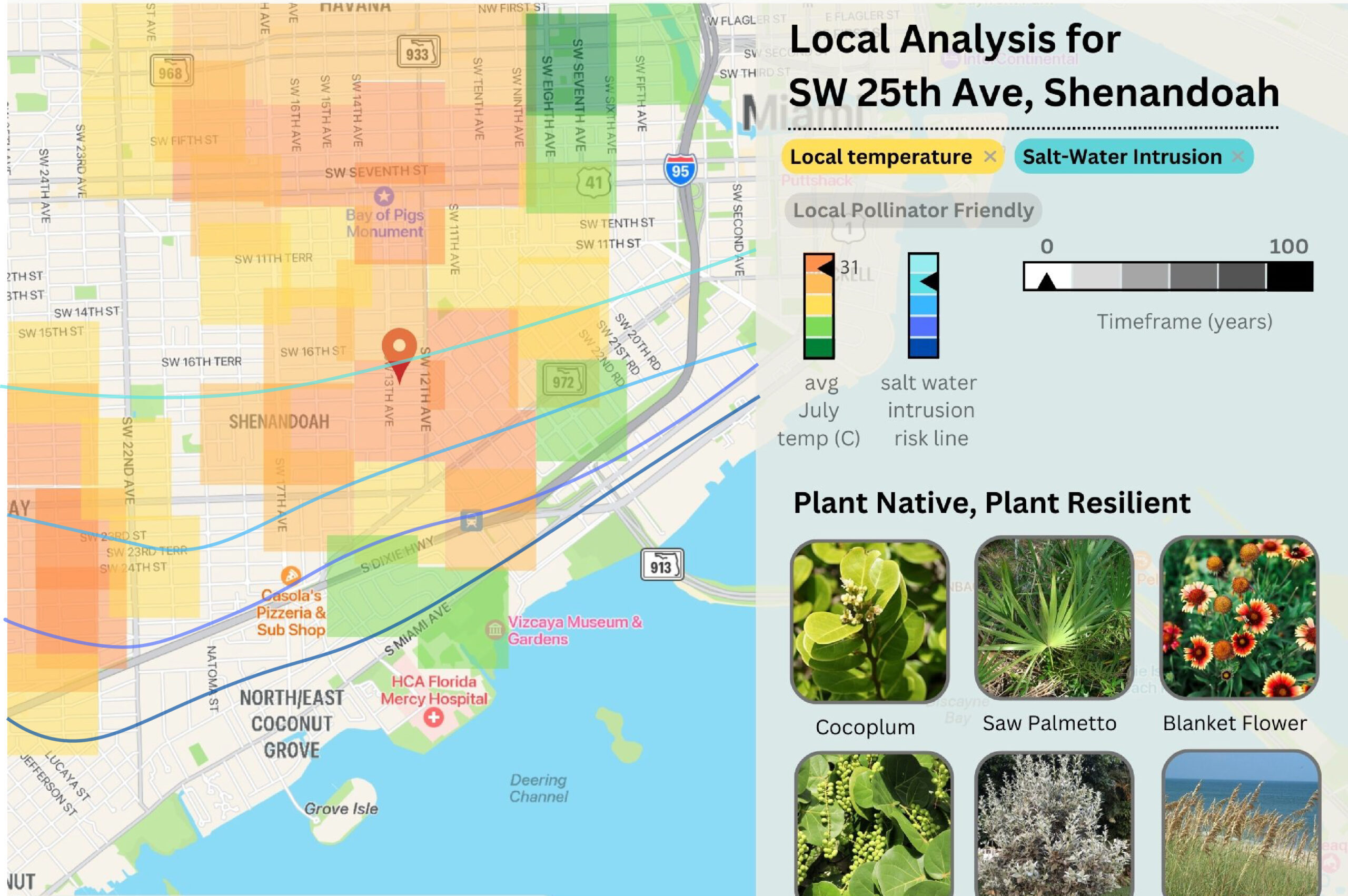
I am visualizing the effects of climate change on plant life in South Florida. I designed the Plant Resilient Project’s website. It uses satellite data tracking heat islands and saltwater intrusion. Users can map where non-heat tolerant or saltwater tolerant plants will die off. This information can inform gardeners and architects on what they should plant where. My data is from heat island maps created by graduate student Oaklin Keefe using data from Landsat 8 imagery, thermal imagery analysis, and Normalized Difference Vegetation Index (NDVI) imagery analysis. I also used saltwater intrusion mapping from the NOAA South Florida sea level rise map. My website looks at a location to find plant species that will resist local environmental shifts caused by climate change. Other information, like how much saltwater intrusion can affect an area, is shown through simple graphics. Gardeners, architects, and city planners can use this website to create green spaces that improve communities in the short- and long-term. It also connects users with nearby native plant nurseries and informs them on plant care, and will help protect local biodiversity.